


Treasure Davis Team · eXp Realty · Colorado Springs
Every part of the Pikes Peak region works differently: different school districts, fee structures, lot types, and commutes. These guides cover the facts, area by area, the way we walk clients through them.
North and the I-25 corridor
El Paso County
Northgate & InterQuest.
Northgate is the fast-growing area where I-25 meets InterQuest and North Gate Boulevards, across from the Air Force Academy's north entrance. Its newer neighborhoods, expanding retail, and corridor position between two metros have made it one of the most-searched parts of the city. This guide covers the questions we hear most.
Area overview
The Northgate area covers the neighborhoods around the I-25 interchanges at North Gate Boulevard and InterQuest Parkway, the city's principal northern growth corner over the past two decades. Communities here include The Farm, Northgate Highlands, and the villages fringing Flying Horse, most of them built from the 2000s onward, with townhome and paired-home products joining single-family in recent phases.
The retail and entertainment build-out is the area's visible story: InterQuest Marketplace added Scheels, In-N-Out, Great Wolf Lodge, and a growing restaurant lineup, and the Ford Amphitheater brought a major outdoor concert venue to the corridor. Hospital-system campuses and offices have followed along InterQuest Parkway.
Typical price range
Northgate-area homes have commonly ranged from about $450,000 to $900,000, townhomes and paired products at the entry point, the core single-family market in the middle of the band, and larger or view homes, particularly on the Flying Horse fringe, toward the top.
School district facts
The Northgate area is served by Academy School District 20, with Discovery Canyon Campus, The Classical Academy's north campus, and other district and charter options in and near the corridor. Northern edges of the area approach the Lewis-Palmer District 38 boundary. Assignments and boundaries are set by the districts and change as the area grows.
Academy School District 20 · Lewis-Palmer School District 38 (northern edges)
HOA and fee notes
Most Northgate-area communities carry conventional HOAs, and many newer filings add metro-district mill levies that fund the corridor's infrastructure, the same model as other recent Colorado Springs master plans. Townhome and paired-home communities carry exterior-maintenance components in their dues.
“I had an amazing experience working with the Treasure Davis team... they demonstrated deep knowledge of the Colorado Springs area and gave great insight to specific neighborhoods on the north side.” Verified Client
El Paso County
Flying Horse.
Flying Horse is north Colorado Springs' flagship golf-club community, custom and semi-custom neighborhoods built around The Club at Flying Horse, its Tom Weiskopf-designed course, and The Lodge resort campus, minutes from I-25 and the Air Force Academy's north gate. This guide covers the questions we hear most.
Area overview
Flying Horse spans the ground between I-25 and Highway 83 north of InterQuest Parkway, developed from the mid-2000s onward as a club-centered master plan. Its villages, a mix of semi-custom and full-custom filings, several of them gated, are organized around The Club at Flying Horse: an 18-hole Tom Weiskopf signature course, athletic club and spa, dining, and The Lodge, a boutique resort that operates within the community.
Architecture skews larger and more custom than neighboring master plans, with ranch and two-story homes from regional custom builders alongside Classic Homes' semi-custom lines. View corridors toward the Front Range and the Academy are a defining lot premium.
Typical price range
Flying Horse homes have commonly ranged from about $750,000 for the community's semi-custom plans to $2,500,000 and above for custom, golf-course, and premium view properties, with the core of the market between those marks. Paired-patio and lock-and-leave products occasionally list below the band.
School district facts
Flying Horse is served by Academy School District 20, with Discovery Canyon Campus, D20's preK-12 campus, adjacent to the community's western villages and other district schools nearby. The Legacy Peak and Da Vinci Academy areas serve nearby filings. Assignments and boundaries are set by the district and should be verified by address.
HOA and fee notes
Flying Horse ownership involves up to three distinct structures, and keeping them straight matters: the homeowners association (covenants, common areas, and design review, with sub-associations and gate fees in some villages), a metro-district component that appears in property taxes for many filings, and The Club at Flying Horse, which is a separate membership organization, buying a home does not automatically include club membership, and membership categories, initiation, and dues are set by the club.
“I cannot recommend the Treasure Davis Team enough! They were deeply knowledgeable about the local market conditions and incredibly patient as we toured various properties until we found the perfect fit. Their expertise made all the difference.” Verified Client
El Paso County
Gleneagle.
Gleneagle is an established community in unincorporated northern El Paso County, between the Northgate area and Monument, known for larger lots, mature landscaping, and quick access to I-25 and the Air Force Academy's north gate. This guide covers what buyers and sellers most often ask us about the area.
Area overview
Gleneagle is a census-designated place in unincorporated El Paso County, roughly bounded by the Air Force Academy to the west, the Northgate/InterQuest area to the south, and the Tri-Lakes area to the north. Development began in the 1970s, which gives the area something newer master plans can't reproduce: mature trees, varied custom and semi-custom architecture, and larger lots on curving, low-traffic streets.
Because it is unincorporated, services work differently than inside Colorado Springs city limits, county road maintenance, and water and sanitation provided by local districts such as Donala Water & Sanitation. Several distinct subdivisions make up the broader Gleneagle area, each with its own covenants and, in some cases, its own homeowners association.
Typical price range
Gleneagle is predominantly a resale market. Homes have commonly ranged from about $500,000 for established two-story and ranch homes to $900,000 for larger custom homes and premium lots. Lot sizes commonly run from a quarter acre to half an acre or more, which is a meaningful difference from newer communities to the south.
School district facts
The Gleneagle area sits near the boundary between two districts: much of Gleneagle is served by Academy School District 20, while portions of the broader area to the north fall within Lewis-Palmer School District 38. Which district serves a given home depends on the specific address, so verification with the districts is essential when schools factor into a purchase.
Academy School District 20 · Lewis-Palmer School District 38
HOA and fee notes
The broader Gleneagle area is a collection of subdivisions rather than a single master plan, and HOA structures vary: some filings carry a modest annual HOA fee for covenant enforcement and common areas, while others have covenants with no active association. There is no community-wide metro district fee comparable to newer master plans, which keeps recurring costs relatively low, but buyers should confirm the specific filing's covenants and any association dues during the title and disclosure period.
“I had an amazing experience working with the team on both the sale of our home and the purchase of our new one. From start to finish, they were incredibly responsive, always quick to answer our questions, and made what could have been a stressful time feel easy.” Verified Client
El Paso County
Monument & Tri-Lakes.
Monument anchors the Tri-Lakes area at the top of the Palmer Divide, midway between Colorado Springs and Denver's southern suburbs on I-25. With a historic downtown, newer neighborhoods like Jackson Creek, and treed established areas like Woodmoor, it draws buyers commuting in both directions. This guide covers the questions we hear most.
Area overview
The Town of Monument sits at the top of the Palmer Divide, the high ground separating the Colorado Springs and Denver basins. The town's historic core dates to the railroad era of the 1870s, and its modern growth runs east of I-25 through Jackson Creek and the surrounding master-planned filings, while the treed Woodmoor area and Palmer Lake round out what locals call the Tri-Lakes region.
Housing spans a genuine range: downtown-adjacent older homes, 1970s-to-1990s houses on treed Woodmoor lots governed by the Woodmoor Improvement Association, and newer construction in Jackson Creek, Sanctuary Pointe, and other recent filings on the district's east side.
Typical price range
Monument-area homes have commonly ranged from about $550,000 to $1,500,000 and above, smaller established homes and townhomes at the entry point, the bulk of single-family activity in the middle, and newer or larger homes in Sanctuary Pointe, Kings Deer, and premium Woodmoor locations toward the top. Golf-course, treed, and view lots carry their own premiums.
School district facts
Monument and most of the Tri-Lakes area are served by Lewis-Palmer School District 38, with the district's schools distributed between the town core, Jackson Creek, and the surrounding area. Portions of the broader region toward Black Forest and the county line fall within neighboring districts, so address-level verification remains important.
Lewis-Palmer School District 38 · Academy School District 20 (southern edges)
HOA and fee notes
HOA structure varies by neighborhood. Woodmoor operates under the Woodmoor Improvement Association, which handles covenants, architectural review, and its own Woodmoor Public Safety patrol, a structure unique in the region. Jackson Creek and newer filings carry conventional HOAs, and some newer communities include metro districts with a mill-levy component. Downtown-adjacent streets may have no association at all.
“As out-of-state buyers, we were nervous about navigating a new housing market from afar. The Treasure Davis Team went above and beyond to make us feel comfortable, conducting detailed walk-throughs on our behalf and handling every piece of the transaction seamlessly. We love our new home!” Verified Client
Douglas County
Castle Rock.
Castle Rock sits at the north end of the I-25 corridor in Douglas County, roughly halfway between Colorado Springs and Denver, with a walkable historic downtown, large master-planned communities, and the butte that gives the town its name. Buyers here are usually weighing a commute in one or both directions. This guide covers the questions we hear most.
Area overview
Castle Rock is the Douglas County seat, a home-rule town built around its 1870s railroad-era downtown and the rock formation on the eastern skyline. Growth over the past two decades has been concentrated in master-planned communities on both sides of I-25: The Meadows and Red Hawk to the west, Crystal Valley and the Terrain and Castlewood Ranch areas to the south and east, and Castle Pines and the Village to the north.
Amenities are unusually strong for a town this size. Philip S. Miller Park, the Miller Activity Complex, and the Rock Park trail system sit inside town limits, the Outlets at Castle Rock and downtown's restaurant blocks handle retail and dining, and two hospital campuses serve the area. Housing runs from 1900s downtown-adjacent cottages to current new construction.
Typical price range
Castle Rock homes have commonly ranged from about $500,000 to $1,500,000 and above, townhomes and smaller established homes at the entry point, the core single-family and new-construction market through the middle, and custom homes on acreage or premium view lots in the Village, Sapphire Pointe, and Escavera at the top. Douglas County pricing generally runs above comparable El Paso County product.
School district facts
Castle Rock is served by Douglas County School District RE-1, one of the larger districts in Colorado, with neighborhood elementary and middle schools inside the master plans and several high schools serving different parts of town. The district also runs charter and magnet options. Assignments and boundaries are set by the district and shift as new filings open, so verify by address.
Douglas County School District RE-1
HOA and fee notes
Metro districts are the norm in Castle Rock's newer communities: a metropolitan district mill levy appears in the property-tax bill and funds roads, water infrastructure, and parks, and a separate HOA handles covenants, design review, and common areas. Total carrying cost varies meaningfully between filings, so we pull the mill levy and the association budget on any home we write. Older downtown-adjacent streets often have no association at all. Water in this part of Douglas County is a real diligence item, and Castle Rock Water publishes its supply planning.
“The Treasure Davis Team was phenomenal when we were looking in the Castle Rock/Douglas County area. They were incredibly knowledgeable about local market trends, property values, and HOA details. They guided us step-by-step through a competitive bidding process without making us feel rushed. Truly professional from start to finish!” Verified Client
El Paso County
Black Forest.
Black Forest is a large unincorporated area northeast of Colorado Springs, defined by ponderosa pine forest, custom homes on acreage, and rural land-use patterns unlike anywhere else in the metro. Buying or selling here involves a different checklist, wells, septic, zoning, and mitigation, and this guide covers the questions we hear most.
Area overview
Black Forest covers a broad swath of unincorporated El Paso County roughly bounded by Monument and Gleneagle to the west, Highway 83 corridors, and the growing northeast edge of Colorado Springs to the south. The area takes its name from the dense stand of ponderosa pine that covers much of it, a genuine forest at 7,000+ feet, minutes from city retail.
Housing is predominantly custom and semi-custom homes on parcels commonly ranging from 2.5 to 5 acres and larger, with many properties zoned for horses and outbuildings. There is no municipal government; land use is governed by El Paso County zoning, and most properties rely on private wells and septic systems rather than municipal utilities.
Typical price range
Black Forest pricing is driven by land, trees, outbuildings, and the home itself, so the range is wide: homes have commonly ranged from about $700,000 to $2,500,000 and above for substantial custom homes on acreage. Vacant land and horse-ready properties trade in their own submarkets.
School district facts
Black Forest is large enough that three districts serve portions of it: Academy School District 20 to the west and south, Lewis-Palmer School District 38 to the northwest, and El Paso County School District 49 to the south and east. The district for any given property depends entirely on where in the Forest it sits, so address-level verification is essential.
Academy School District 20 · Lewis-Palmer School District 38 · El Paso County School District 49
HOA and fee notes
Most Black Forest properties are served by private wells and septic systems. Colorado law requires a septic use permit and inspection at transfer in El Paso County, and well permits carry defined allowed uses, household use, irrigation, and livestock allowances differ by permit type. Well production, water quality testing, and septic condition are standard inspection items we build into every Black Forest contract.
“I had the most wonderful experience with the Treasure Davis Team. They make the whole process fun and entertaining but keep things moving forward... The entire experience was phenomenal. I can't imagine this experience being made better working with anyone else. The team's sense of humor and no-nonsense attitude definitely takes the stress out of the buying experience.” Verified Client
Briargate, the Powers corridor and the eastern plains
El Paso County
Briargate.
Briargate is one of the largest residential areas in Colorado Springs, a master plan that began in the early 1980s and now spans established neighborhoods, the Pine Creek golf community, and the city's biggest north-side retail. This guide covers what buyers and sellers most often ask us about it.
Area overview
Briargate occupies a large area of north Colorado Springs between I-25 and Powers Boulevard, roughly from Woodmen Road north to InterQuest Parkway. Development began in the early 1980s under a single master plan, which is why the area reads as a coherent whole: connected parks, greenways, school sites planned into neighborhoods, and retail concentrated along Briargate Parkway and Academy Boulevard.
Housing spans four decades. Original 1980s and 1990s neighborhoods offer established trees and larger yards at the area's most accessible price points; 2000s filings add newer construction; and Pine Creek, built around the Pine Creek Golf Club, carries the area's larger semi-custom and custom homes along with patio-home enclaves.
Typical price range
Briargate homes have commonly ranged from about $425,000 to $700,000, townhomes and patio homes at the entry point, established single-family homes through the heart of the band, and Pine Creek's golf-course and view streets at and above the top of it.
School district facts
Briargate is served by Academy School District 20, with elementary, middle, and high schools located throughout the master plan, and District 49 serving areas east of Powers. School sites were planned into Briargate's neighborhoods from the beginning, so most filings sit near a district school. Assignments and boundaries are set by the district and change over time.
Academy School District 20 · El Paso County School District 49 (east of Powers)
HOA and fee notes
Most Briargate neighborhoods carry conventional homeowners associations with modest annual or monthly dues covering common areas and covenant enforcement; patio-home and townhome communities add exterior-maintenance components. Pine Creek's sub-associations include design review for exterior changes. Fees and rules vary filing by filing, and buyers receive the applicable governing documents during the contract period.
“The Treasure Davis Team was incredibly responsive to all my questions and concerns throughout our homebuying process... helped us get an amazing deal on our new home in the Northeast area and we are so grateful.” Verified Client
El Paso County
Cordera.
Cordera is a master-planned community in north Colorado Springs, east of Powers off Briargate Parkway, built from the mid-2000s onward around a residents' community center, connected parks, and on-site District 20 schools. This guide covers what buyers and sellers most often ask us about it.
Area overview
Cordera occupies the high ground between Powers Boulevard and Black Forest's southern edge, built out by a mix of national and regional builders from the mid-2000s through current phases. The plan centers on the Cordera Community Center, pool, fitness rooms, gathering spaces, and a year-round events calendar run by the community's full-time staff, with a Grand Lawn hosting summer concerts and seasonal events.
The neighborhood's layout emphasizes connection: parks and green corridors thread between filings, sidewalks and trails link to the schools built inside the community, and streets terminate into green space more often than into arterials.
Typical price range
Cordera homes have commonly ranged from about $650,000 to $1,100,000, the community's smaller plans at the entry point and larger semi-custom homes on premium lots at the top. New phases continue to release alongside an active resale market.
School district facts
Cordera is served by Academy School District 20, and the master plan includes schools inside the community, Chinook Trail Elementary and Chinook Trail Middle School, with district high-school assignments nearby. Boundaries and assignments are set by the district and can change as the north side grows.
Academy School District 20 · El Paso County School District 49 (east of Cordera)
HOA and fee notes
Cordera operates with a master association whose dues fund the community center, pool, events staff, parks, and common-area maintenance, the amenity programming is a defining feature of the community and its fee reflects that. Some filings carry additional sub-association or maintenance components, and design guidelines govern exterior changes and landscaping.
“I cannot recommend the Treasure Davis Team enough! They were deeply knowledgeable about the local market conditions and incredibly patient as we toured various properties until we found the perfect fit. Their expertise made all the difference.” Verified Client
El Paso County
Wolf Ranch.
Wolf Ranch is a master-planned community in northeast Colorado Springs organized around Wolf Lake and its park system, with active new-construction phases alongside an established resale market that dates to the mid-2000s. This guide covers what buyers and sellers most often ask us about it.
Area overview
Wolf Ranch sits east of Powers between Research Parkway and Briargate Parkway's eastern reach, with development beginning around 2004 and accelerating through the 2020s. The community's centerpiece is Wolf Lake, a park-wrapped lake with paddle access, fishing, a dog park, splash pad, and event lawns, with trail spines connecting the filings around it.
Housing spans the community's two eras: mid-2000s resale neighborhoods in the original filings, and current new-construction phases from national and regional builders in the community's newer sections, with plans from paired homes through large two-stories.
Typical price range
Wolf Ranch homes have commonly ranged from about $500,000 to $900,000, resale homes from the original filings across the lower and middle of the band, and new construction running through the band depending on builder, plan, and lot, with premium view and lake-adjacent properties at the top.
School district facts
Wolf Ranch is served by Academy School District 20, with Legacy Peak Elementary inside the community and Chinook Trail Middle School and district high schools serving the area. Wolf Ranch's eastern edges approach the District 49 boundary, so address-level verification matters, particularly in newer phases.
Academy School District 20 · El Paso County School District 49 (eastern edges)
HOA and fee notes
Wolf Ranch uses the metro-district model common to newer Colorado Springs master plans: a metropolitan district mill levy appears in property taxes and funds infrastructure, while association fees fund the lake park, common areas, and community programming. Amounts differ between the community's filings and change over time.
“I had an amazing experience working with the team on both the sale of our home and the purchase of our new one. From start to finish, they were incredibly responsive, always quick to answer our questions, and made what could have been a stressful time feel easy.” Verified Client
El Paso County
Banning Lewis Ranch.
Banning Lewis Ranch is one of the largest master-planned communities on the east side of Colorado Springs, with new-construction and resale homes, on-site schools, pools, parks, and a network of trails. This guide covers what buyers and sellers most often ask us about the neighborhood.
Area overview
Banning Lewis Ranch sits east of Marksheffel Road, north of Woodmen Road, within Colorado Springs city limits. The master plan covers a large area of the city's eastern growth corridor and has been building out since the mid-2000s, so housing ranges from established resale streets to brand-new phases still under construction.
The community is organized around amenity centers, including the Ranch House and Vista House, with pools, a splash park, fitness space, community gardens, and a calendar of neighborhood events run by the community's own staff. Streets connect to parks and trail corridors rather than to through-traffic arterials.
Typical price range
Banning Lewis Ranch offers a wide price span for the east side because new builds and resales trade in the same neighborhood: homes have commonly ranged from about $425,000 to $750,000, with attached and smaller detached homes at the entry point and larger or highly upgraded homes at the top. Exact pricing depends on the phase, builder, plan, and lot.
School district facts
Banning Lewis Ranch is served by El Paso County School District 49, and the master plan includes on-site public charter options: Banning Lewis Ranch Academy (K-8) and Banning Lewis Preparatory Academy (6-12) operate inside the community, with additional District 49 neighborhood schools nearby. Enrollment options, boundaries, and programs are set by the district and the individual schools.
El Paso County School District 49 · Banning Lewis Ranch Academy (D49 charter)
HOA and fee notes
Like many newer Colorado Springs master plans, Banning Lewis Ranch uses a metropolitan district structure rather than a traditional stand-alone HOA. The metro district levies a property-tax mill levy that funds infrastructure, and residents also pay a recurring fee that covers the amenity centers, pools, community programming, and common-area maintenance. Trash service and front-yard or common landscaping are bundled in some filings.
“I had an amazing experience working with the team on both the sale of our home and the purchase of our new one... They really understand the nuances of the market on the east side of town.” Verified Client
El Paso County
Falcon.
Falcon is the unincorporated area northeast of Colorado Springs where Highway 24 meets Woodmen Road, and it has become the region's value play: newer homes on larger lots, amenity-heavy metro-district communities, and quick access to Schriever and Peterson. This guide covers what buyers and sellers most often ask us about it.
Area overview
Falcon is unincorporated El Paso County, not a municipality, spread around the Highway 24 and Woodmen Road junction east of Colorado Springs. Growth came in waves from the 1990s onward, and the area now reads as a set of distinct communities rather than one town: Meridian Ranch and its Antler Creek golf course, Woodmen Hills with its two recreation centers, Paint Brush Hills, Falcon Hills, Latigo Trails, and a widening ring of newer filings and acreage between them.
Day-to-day services have caught up with the growth. Retail and grocery cluster along Woodmen and Highway 24, Falcon Regional Park and the district's schools sit inside the residential core, and commuters reach the Powers corridor, Peterson, and Schriever without going through the city. Lots are typically larger than comparable Colorado Springs product at the same price.
Typical price range
Falcon-area homes have commonly ranged from about $400,000 to $800,000, entry-level and starter-size homes at the bottom of the band, the core of the market in newer single-family construction through the middle, and larger homes, golf-course lots in Meridian Ranch, and homes on 2.5-plus acres at the top. Acreage and horse properties east of the core trade in their own submarket.
School district facts
Most of Falcon is served by El Paso County School District 49, whose Falcon and Sand Creek zones cover the area, with elementary, middle, and high school campuses in and around the community along with district charter options. Portions of the broader area to the north and east fall within Peyton School District 23-JT or other neighboring districts, so verification by address matters here.
El Paso County School District 49 · Peyton School District 23-JT (northern and eastern edges)
HOA and fee notes
Fee structure is the single biggest thing to understand in Falcon, and it varies more here than almost anywhere in the region. Meridian Ranch and Woodmen Hills operate metropolitan and service districts that fund water, infrastructure, and their recreation centers through mill levies and monthly fees. Other filings carry a conventional HOA, and properties outside the districts often have no association but rely on private wells and septic systems, with the county's transfer inspection requirements attached. We check the district, the water source, and the total monthly carrying cost on every Falcon home before writing.
“Working with the Treasure Davis Team in Falcon was the best real estate decision we’ve made. They knew every neighborhood, master-planned community, and local nuance. Our agent had immediate answers about lot sizes, local utilities, and school districts. They helped us win our dream home under budget!” Verified Client
El Paso County
Peyton.
Peyton is the rural stretch of eastern El Paso County beyond Falcon, where the plains open up: acreage, horse property, wells and septic, and a small-town school district. It is the area buyers choose when land matters more than a short commute. This guide covers the questions we hear most.
Area overview
Peyton sits along the Highway 24 corridor east of Falcon, an unincorporated community with a small commercial core and a large rural area around it. There is no municipal government, land use runs through El Paso County zoning, and the character is genuinely agricultural: fenced pasture, outbuildings, barns, and long views back toward Pikes Peak.
Property here is mostly custom, owner-built, and manufactured or modular homes on parcels from 5 acres up past 40, with a share of vacant land trading every year. Many properties are zoned for livestock and horses, and the practical questions are about the land as much as the house: access and road maintenance, fencing, wind exposure, and how far services reach.
Typical price range
Peyton-area properties have commonly ranged from about $400,000 to $900,000 and above, smaller homes and manufactured homes on acreage at the entry point, the core of the market in custom homes on 5 to 10 acres, and larger custom homes with substantial outbuildings or significant acreage at the top. Vacant land trades in its own submarket and is priced by acreage, access, and water.
School district facts
Peyton is served primarily by Peyton School District 23-JT, a small district with its elementary and combined junior/senior high campuses in town, while portions of the surrounding area fall within El Paso County School District 49 or other neighboring rural districts. District lines out here follow historic boundaries rather than roads, so verifying the assignment for a specific parcel is essential.
Peyton School District 23-JT · El Paso County School District 49 (western portions)
HOA and fee notes
Most Peyton properties have no HOA, and the ones that do are typically covenant-only with a small annual fee. What replaces the HOA checklist is a land checklist: well permit type and allowed uses, well production and water quality, septic use permit and transfer inspection, propane versus electric service, road maintenance responsibility on shared or private drives, and legal access. These are the items we build into every acreage contract we write out here.
“If you are buying or selling out in Peyton, hire this team! Their knowledge of acreage properties, outbuildings, and local developments is unmatched. They listened to our exact needs, set up quick showings, and advocated hard for us during negotiations.” Verified Client
The westside and foothills
El Paso County
Garden of the Gods Area, Rockrimmon & Ute Valley.
Northwest Colorado Springs, Rockrimmon, the neighborhoods around Ute Valley Park, and the streets near Garden of the Gods, offers treed hillside living inside city limits, with red-rock views and trail access most cities can't match. This guide covers what buyers and sellers most often ask us about the area.
Area overview
Rockrimmon and the surrounding northwest neighborhoods were built primarily from the 1970s through the 1990s on the wooded hills west of I-25, between Ute Valley Park and the Air Force Academy's southern boundary. The terrain gives the area its character: curving streets, scrub-oak and pine lots, rock outcroppings, and view corridors toward Pikes Peak and the Front Range.
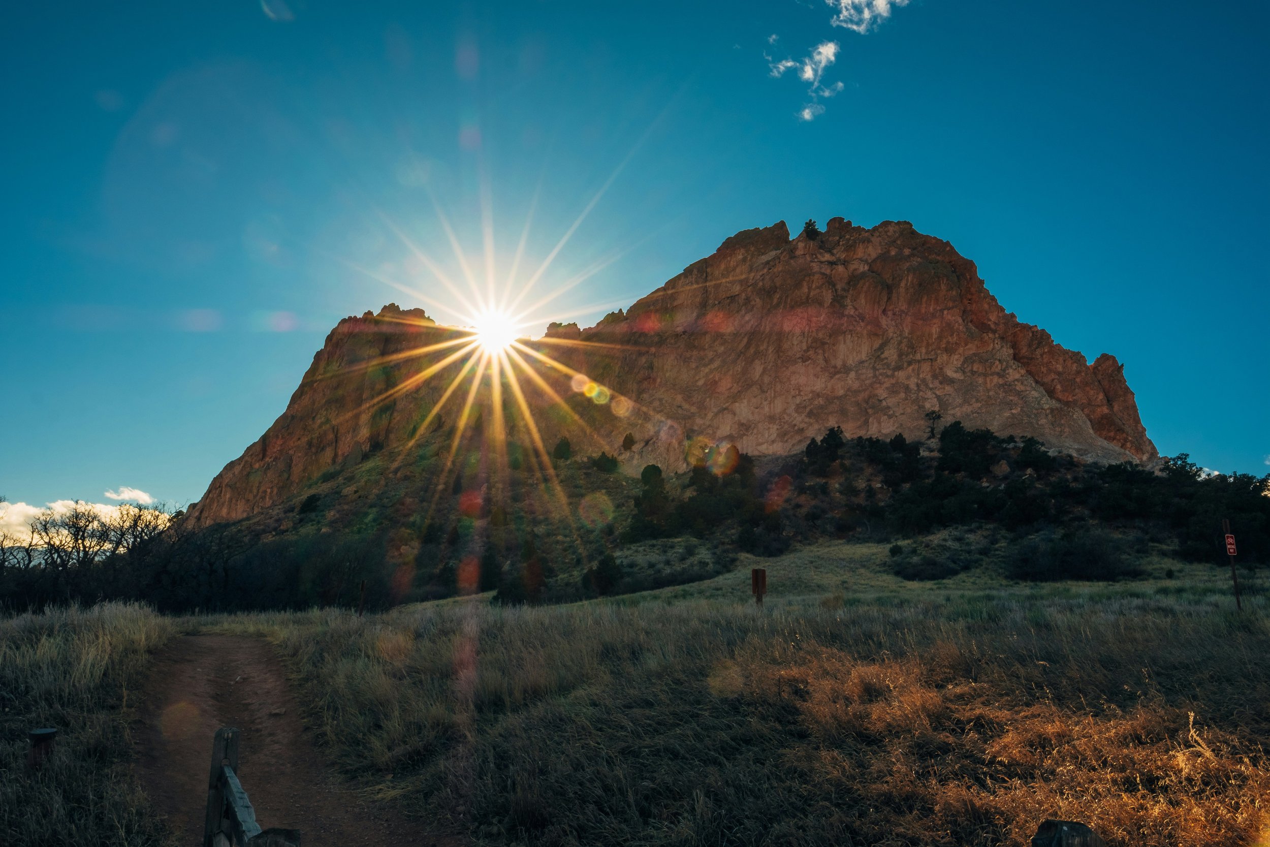
South of the area, Garden of the Gods, a 1,300-plus-acre National Natural Landmark owned by the city and free to the public, anchors the northwest side, with the neighborhoods near 30th Street and the Mesa carrying some of the city's most recognizable red-rock backdrops.
Typical price range
Northwest-side homes have commonly ranged from about $450,000 to $1,200,000, established townhomes and smaller houses at the entry point, the core single-family market in the middle, and larger view and custom properties in upper Rockrimmon, Peregrine's edges, and the gated Kissing Camels golf community at and above the top of the band.
School district facts
Most of Rockrimmon and the Ute Valley-area neighborhoods are served by Academy School District 20, while streets closer to Garden of the Gods and the Mesa fall within Colorado Springs School District 11. The D20/D11 boundary crosses the northwest side, so the district for a given home depends on the address.
Academy School District 20 · Colorado Springs School District 11
HOA and fee notes
HOA structure varies: many Rockrimmon filings carry modest associations for covenant enforcement and common areas, townhome communities carry maintenance components, and Kissing Camels operates as a gated golf community with its own association structure. Other established streets have covenants without active associations. Buyers receive the applicable documents during the contract period.
“I had the most wonderful experience with the Treasure Davis Team... they make the whole process fun and entertaining but keep things moving forward... fully prepared for every showing in the Northwest.” Verified Client
El Paso County
Peregrine & Mountain Shadows.
Peregrine and Mountain Shadows climb the foothills of northwest Colorado Springs below Blodgett Peak, custom and semi-custom homes on terrain lots with Front Range views, direct trail access, and city services. This guide covers what buyers and sellers most often ask us about the foothills neighborhoods.
Area overview
Peregrine occupies the upper foothills along Woodmen Road's western end, developed from the late 1980s through the 2000s with custom and semi-custom homes on terrain lots that back to open space and climb toward Blodgett Peak. Mountain Shadows, below it along the Centennial corridor, dates originally to the 1970s and 80s.
Mountain Shadows carries a distinctive fact pattern: the 2012 Waldo Canyon fire destroyed hundreds of homes there, and the neighborhood rebuilt, which means much of its housing stock is 2013-and-newer construction inside an established 1980s street grid, with modern codes, systems, and finishes uncommon for the area's price band.
Typical price range
Homes across Peregrine and Mountain Shadows have commonly ranged from about $650,000 to $1,800,000 and above, Mountain Shadows' rebuilt streets offering newer construction toward the lower half of the band, and Peregrine's custom and semi-custom homes on premium view and open-space lots at the top.
School district facts
Peregrine and Mountain Shadows are served by Academy School District 20, whose schools serve the area's filings from the Woodmen and Centennial corridors. The southern blocks of Mountain Shadows approach the Colorado Springs District 11 boundary, so verification by address applies at the edges.
Academy School District 20 · Colorado Springs School District 11 (southern edges)
HOA and fee notes
HOA structure varies by filing: Peregrine's villages carry associations with design guidelines protecting the neighborhood's architectural consistency, while Mountain Shadows' streets range from active associations to covenant-only. Buyers receive the applicable documents during the contract period.
“I had the most wonderful experience with the Treasure Davis Team. They make the whole process fun and entertaining but keep things moving forward... The entire experience was phenomenal. I can't imagine this experience being made better working with anyone else. The team's sense of humor and no-nonsense attitude definitely takes the stress out of the buying experience.” Verified Client
El Paso County
Old Colorado City.
Old Colorado City is the historic westside of Colorado Springs, founded in 1859, briefly the territorial capital's seat of government, and today a walkable district of restored storefronts on Colorado Avenue surrounded by some of the city's oldest housing. This guide covers what buyers and sellers most often ask us about the westside.
Area overview
Old Colorado City was founded in 1859 during the Pikes Peak gold rush, twelve years before Colorado Springs, and served briefly as the first capital of the Colorado Territory. Annexed into Colorado Springs in 1917, the district kept its own identity: the restored 1880s-1900s commercial blocks along West Colorado Avenue now hold restaurants, galleries, and independent shops, with a National Register historic commercial district at the core.
The surrounding residential streets carry the westside's characteristic housing: Victorian cottages, miner-era frame houses, and 1900s-1920s bungalows, joined over the decades by mid-century infill and, more recently, townhome and single-family redevelopment. Lot sizes are city-scaled, alleys are common, and many homes have been renovated one or two times over their century of life.
Typical price range
Westside homes have commonly ranged from about $400,000 to $900,000, smaller cottages and homes awaiting updates at the entry point, renovated bungalows and mid-size homes through the middle, and larger renovated Victorians, view properties, and newer construction at the top of the band.
School district facts
Old Colorado City and the surrounding westside are served by Colorado Springs School District 11, with neighborhood schools on the westside and district-wide choice enrollment options. Addresses at the area's western edge approach the Manitou Springs District 14 boundary, so verification by address applies there.
Colorado Springs School District 11 · Manitou Springs School District 14 (western edges)
HOA and fee notes
Most westside streets have no HOA, covenants and dues are the exception rather than the rule, generally limited to newer townhome and infill projects. What replaces the HOA checklist is an older-home checklist: sewer line condition and material, foundation and settling history, electrical service and knob-and-tube remnants, and the permit history of past renovations.
“The Treasure Davis Team was incredibly supportive throughout our transaction. They know the central areas of the city inside and out and helped us navigate a seamless purchase close to everything we needed.” Verified Client
El Paso County
Manitou Springs.
Manitou Springs is its own home-rule city at the base of Pikes Peak, founded around its natural mineral springs and now home to one of the country's larger National Historic Districts. Its housing stock, Victorian-era homes, hillside cottages, and everything between, behaves unlike any other market in the region. This guide covers the questions we hear most.
Area overview
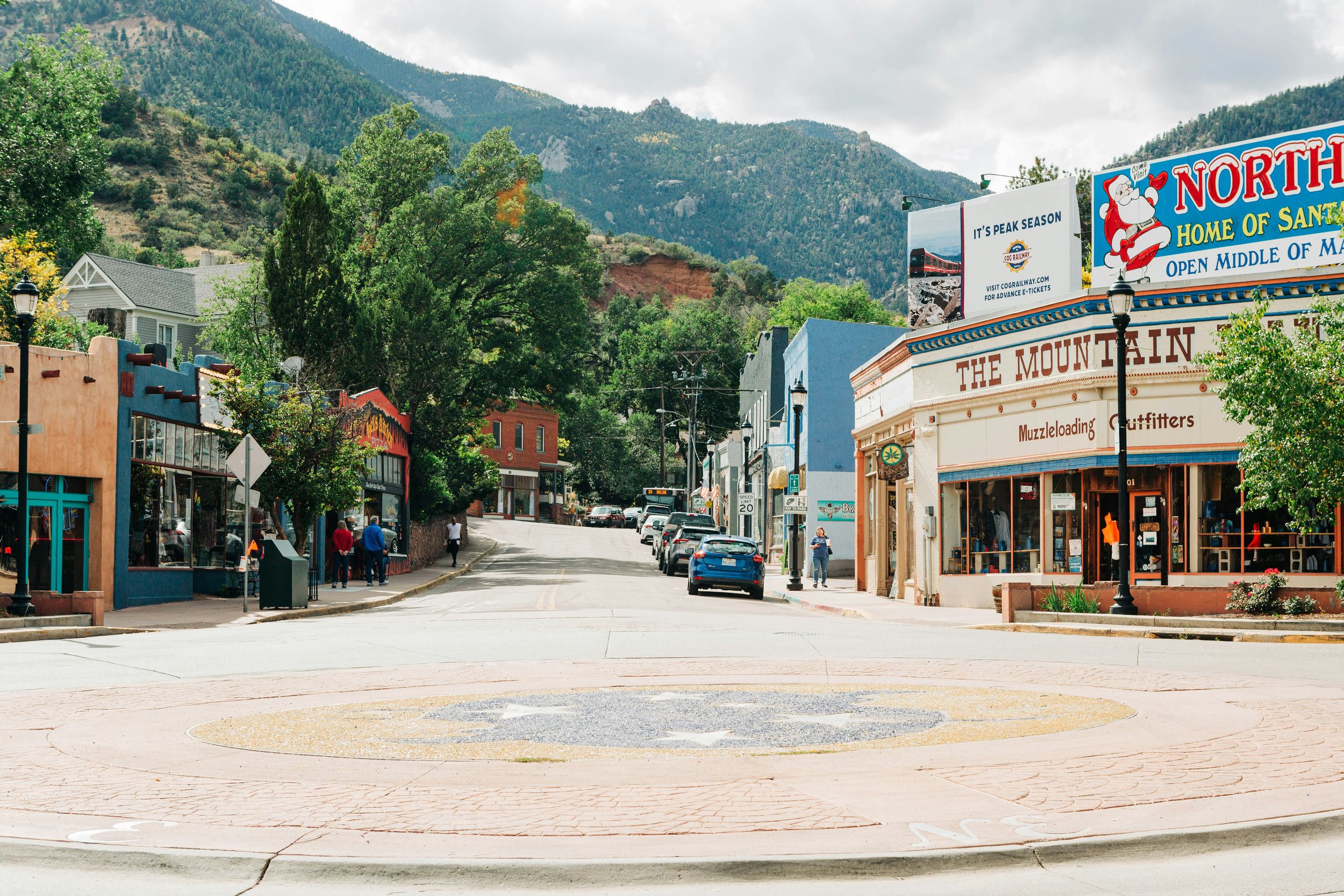
Manitou Springs was founded in 1872 around its naturally carbonated mineral springs, and eight public spring fonts still flow in and around its downtown. The town is a home-rule municipality, its own government, police, and planning, tucked into the canyon where US-24 meets the base of Pikes Peak, bordered by Garden of the Gods to the northeast and national forest to the west.
The Manitou Springs Historic District, established locally in 1980 and listed on the National Register, covers much of the town and is among the larger National Historic Districts in the country. Housing runs from 1880s–1920s Victorians and cottages in the core to mid-century and newer homes in Crystal Hills and the hillside fringes.
Typical price range
Manitou's inventory is small, a few dozen sales in a typical year, so pricing swings more with individual property character than with broad averages. Homes have commonly ranged from about $450,000 to $1,200,000 and above, with condos and smaller cottages at the entry point and larger Victorians, view homes, and Crystal Hills properties at the top.
School district facts
Manitou Springs is served by its own district, Manitou Springs School District 14, with its elementary, middle, and high school campuses in and adjacent to town. Some addresses in the surrounding hills fall within neighboring districts, so address-level verification still applies at the edges.
Manitou Springs School District 14 · Colorado Springs School District 11 (eastern edges)
HOA and fee notes
Within the historic district, exterior alterations visible from the street, siding, windows, additions, may require a review by the city's historic preservation process before permits issue. Buyers planning renovations should scope that process into their timeline, and sellers with completed approved work should document it, because it adds credibility at resale.
“As out-of-state buyers, we were nervous about navigating a new housing market from afar. The Treasure Davis Team went above and beyond to make us feel comfortable, conducting detailed walk-throughs on our behalf and handling every piece of the transaction seamlessly. We love our new home!” Verified Client
Central, southwest and the mountains
El Paso County
Old North End.
The Old North End is Colorado Springs' signature historic neighborhood, tree-lined avenues of Victorian, Craftsman, and revival-style homes laid out in the city's earliest decades, running north from downtown past Colorado College. It is a National Register historic district with a local preservation overlay, and buying or selling here has its own playbook. This guide covers the questions we hear most.
Area overview
The Old North End grew along Cascade, Nevada, Tejon, and Wood Avenues in the decades after General William Jackson Palmer founded Colorado Springs in 1871, and much of its housing dates from the 1880s through the 1920s, Queen Annes, Craftsman bungalows, foursquares, and revival styles under a canopy of mature street trees. The neighborhood is listed on the National Register of Historic Places.
Its neighbors define daily life: Colorado College borders the district's southern blocks, Monument Valley Park runs its western edge along Monument Creek, downtown sits minutes south, and the Penrose Hospital campus anchors the north end. Few Colorado Springs neighborhoods put this much within walking distance.
Typical price range
The Old North End is finite, no new streets will ever be added, and turnover is modest, so inventory is chronically thin. Homes have commonly ranged from about $700,000 to $2,000,000 and above, with mid-size historic homes through the middle of the band and the district's larger restored Victorians and avenue-front homes at the top.
School district facts
The Old North End is served by Colorado Springs School District 11, whose downtown-area schools serve the district alongside D11's district-wide choice enrollment. Several independent schools also operate in and near the neighborhood. Assignments and boundaries are set by the district and change over time.
Colorado Springs School District 11
HOA and fee notes
There is no HOA in the Old North End, the neighborhood's governing layer is the city's historic preservation overlay. Exterior alterations on contributing properties, additions, window replacement, porch work, demolition, require review and approval through the city's preservation process before permits issue. Interior renovations are generally not restricted. The Old North End Neighborhood association is active but voluntary.
“I had an amazing experience working with the team on both the sale of our home and the purchase of our new one. From start to finish, they were incredibly responsive, always quick to answer our questions, and made what could have been a stressful time feel easy.” Verified Client
El Paso County
Cheyenne Mountain & The Broadmoor Area.
The southwest side of Colorado Springs, the Broadmoor area, Broadmoor Bluffs, Skyway, Cheyenne Cañon, and the neighborhoods along Cheyenne Mountain, is one of the city's oldest and most varied housing areas, ranging from 1920s estates to modern hillside construction. This guide covers what buyers and sellers most often ask us about it.
Area overview
The Broadmoor area grew up around The Broadmoor hotel, which opened in 1918 at the base of Cheyenne Mountain, and the surrounding neighborhoods were annexed into Colorado Springs in 1980. The result is a southwest quadrant with genuine architectural range: early-1900s estates near the resort, mid-century homes in Skyway and Cheyenne Cañon, and newer hillside construction in Broadmoor Bluffs, Broadmoor Glen, Stratton Preserve, and along the mountain's lower slopes.
Terrain defines the area. Streets climb from the valley floor toward Cheyenne Mountain and North Cheyenne Cañon, so lot topography, views, and access vary house to house in a way flat neighborhoods don't. Cheyenne Mountain itself, home to the Cheyenne Mountain Space Force Station complex, and the Will Rogers Shrine of the Sun are the area's most recognizable landmarks.
Typical price range
Southwest Colorado Springs spans nearly the entire metro price spectrum: homes have commonly ranged from about $700,000 to $5,000,000 and above, with established single-family homes in Skyway and the Broadmoor-area flats toward the lower half of the band and hillside custom homes, view properties, and estate listings at the top. Condos, townhomes, and smaller homes near the resort corridor can trade below the band.
School district facts
Much of the Broadmoor and Cheyenne Mountain area is served by Cheyenne Mountain School District 12, with portions of the broader southwest side falling within Colorado Springs School District 11 and Harrison School District 2 depending on the address. District boundaries thread through this part of the city, so verifying the assignment for a specific address is especially important here.
Cheyenne Mountain School District 12 · Colorado Springs School District 11 · Harrison School District 2
HOA and fee notes
HOA structure varies widely: many older Broadmoor-area and Skyway streets have no association at all, while newer hillside subdivisions like Broadmoor Bluffs and Stratton Preserve carry active HOAs with design guidelines. Condo and townhome communities near the resort corridor have their own associations and monthly dues. Buyers receive the applicable governing documents during the contract period.
“I highly recommend the Treasure Davis Team. They were professional, completely on top of details, and made our home purchase in Southwest Colorado Springs incredibly smooth.” Verified Client
Teller County
Woodland Park.
Woodland Park, 'the City Above the Clouds', sits at roughly 8,500 feet in Teller County, twenty minutes up Ute Pass from Colorado Springs, with front-row Pikes Peak views and a genuine mountain-town housing market that runs from in-town streets to forested acreage. This guide covers what buyers and sellers most often ask us.
Area overview
Woodland Park grew from an 1880s lumber town into Teller County's largest community, seated where US-24 crests Ute Pass and Highway 67 splits north toward Deckers and south toward Cripple Creek. Pikes Peak fills the southern skyline from most of town, the view that gives Woodland Park its identity.
Housing splits into two markets: in-town neighborhoods on city water and sewer, with everything from older cottages to newer subdivisions, and the surrounding forested areas, Paradise Estates, Sunnywood, and unincorporated Teller County beyond, where acreage, wells, and septic are the norm.
Typical price range
Woodland Park homes have commonly ranged from about $450,000 to $1,200,000 and above, in-town cottages and townhomes at the entry point, the core single-family market through the middle, and view homes, larger custom properties, and acreage estates at the top. Vacant land trades in its own submarket across Teller County.
School district facts
Woodland Park and much of surrounding Teller County are served by Woodland Park School District RE-2, with campuses in town. Areas toward Divide and Cripple Creek fall within neighboring Teller County districts, so address-level verification applies outside town.
Woodland Park School District RE-2 · Cripple Creek-Victor RE-1 (southwest county)
HOA and fee notes
In-town properties generally run on Woodland Park city water and sewer with conventional, often HOA-free streets; outside city limits, private wells and septic systems are the norm, with the same transfer-inspection and permit framework as other Colorado mountain counties. Well production, water quality, and septic condition are standard buyer inspection items on acreage.
“I cannot recommend the Treasure Davis Team enough! They were deeply knowledgeable about the local market conditions and incredibly patient as we toured various properties until we found the perfect fit. Their expertise made all the difference.” Verified Client
Ready when you are
Tell us which area fits your move.
Since 2005 the Treasure Davis Team has closed more than 3,500 homes across the Pikes Peak region. We will walk through your commute, budget, and priorities and share current data for any community on this page.
The Treasure Davis Team · 5155 N Academy Blvd, Suite 200, Colorado Springs, CO 80918 · Brokered by eXp Realty
Equal Housing Opportunity
The Treasure Davis Team supports the principles of the Fair Housing Act and the Colorado Anti-Discrimination Act. We do business in accordance with federal and state fair housing laws and do not discriminate on the basis of race, color, religion, national origin, sex, familial status, disability, sexual orientation, gender identity, marital status, source of income, ancestry, creed, or any other protected class.
The information on this page is provided for general informational purposes only. School district names and boundaries are set by each district and change over time; families should verify assignments for a specific address with the district. Price ranges are rounded historical references, not current market statistics, appraisals, or predictions. HOA, metro district, and covenant details vary by filing and are delivered during the contract period. Commute times are typical-drive references and vary with traffic and season.
The Treasure Davis Team is a real estate team operating under eXp Realty, LLC. All real estate services are provided in accordance with the rules of the Colorado Real Estate Commission and the Division of Real Estate. Office: 5155 N Academy Blvd, Suite 200, Colorado Springs, CO 80918.

